

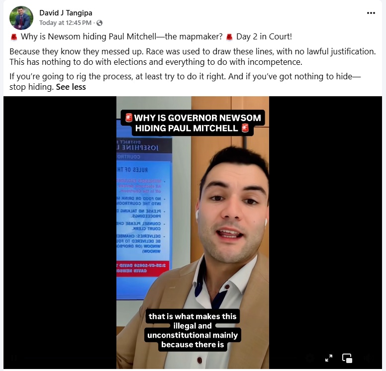
Update on litigation against Prop. 50.
Original article:
Have you voted yet?
If you’re a Sacramento County registered voter having issues with your Special Election ballot, call the Sacramento County Elections Office ASAP! (916) 875-6451 or go in person to 7000 65th Street, Suite A, Sacramento (off Florin Road and Hwy 99).
Don’t forget to fold your ballot with text inside so your No vote is not visible through the holes in the envelope. Easy fix to protect the privacy of your vote! FYI, the holes are meant to guide the seeing-impaired to the signature line and to make it easy for county elections workers to know if the envelope is empty.
Be sure to sign up to have your ballot tracked – use this link on the Secretary of State’s website
There are several ways to turn in your ballot:
You can mail your ballot as long as it is postmarked by Nov. 4th
Here’s the list of Official County Drop Boxes.
Here’s the list of Official Vote Centers open starting October 25th
SacGOP Ballot Collections:
You can bring your ballot in the sealed and signed pink envelope to SacGOP Hdqrts by 2pm on Nov. 3 (Election Eve) and we’ll hand-deliver it to the Sacramento County Elections office for processing the next business day!
About Prop 50
Democrats Launch Proposition 50 To Throw Out Citizens Redistricting Commission Maps
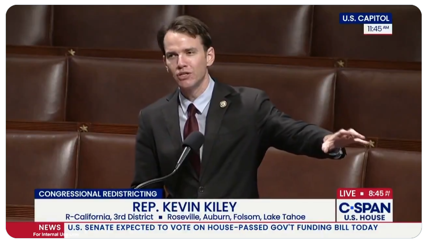
Gov. Gavin Newsom and Assembly Democrats released their gerrymandered legislative map, and all Sacramento Congressional Districts were dramatically changed from those approved by the nonpartisan Citizens Redistricting Commission. Governor Newsom’s primary critic, Representative Kevin Kiley, is the focus of Newsom’s wrath, as Kiley’s district will be padded with Democrats from Sacramento County in an attempt to remove him from Congress. While declaring this will be a transparent process, prior to legislative approval on a party-line vote, Democrats published an analysis that hid the new party registration numbers for districts throughout the State of California while refusing to admit that a Democrat operative drew the new lines. This is why California voters took the power away from politicians in 2008 with Proposition 11 to have a non-partisan citizen’s commission create State Legislative Districts, and in 2010 with Proposition 20 to draw lines for Congressional Districts.
CALLING ALL VOLUNTEERS!
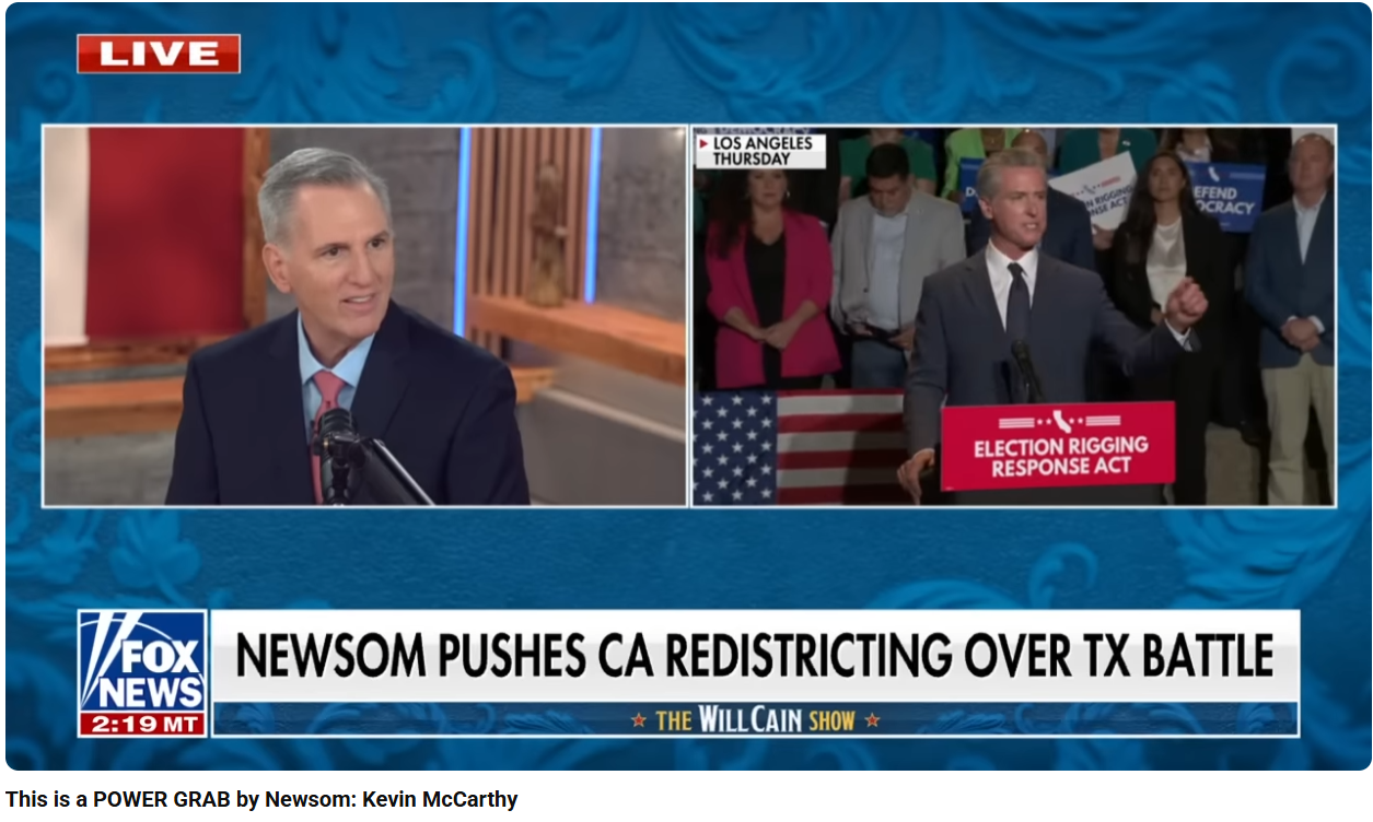
Conservatives agree – Newsom is using Prop 50 and our tax dollars to run for President and wipe out the Republican Congressional Delegation. Let’s do something about that!
It’s time to stop talking to those you know have voted, and get the word out to voters who might not be paying attention! You can spread the news by talking to your neighbors, friends and family. Every vote will matter in this close election!
Contact Info@SacCountyGOP.com to let us know you’d like No on 50 materials to handout.
Sacramento volunteers are needed to call Republican voters who haven’t submitted their ballots. Meet at CAGOP headquarters downtown and they will get you set up!
The CAGOP headquarters is located at 10th & K Streets and public parking is available by entering from 10th Street, between L and K. You must RSVP in order to be admitted through their security. Email Adrienne Coryell at acoryell@cagop.org or call 916.503.1228.

More Details:
-
ACA 8 (Rivas, McGuire), which authorizes the replacement of the existing Congressional map
-
AB 604 (Aguiar-Curry), which contains the new proposed Congressional map for voter approval
-
SB 280 (Cervantes, Pellerin) to call the special election, appropriate funding for election administration, and make conforming changes to election calendars.
More Resources:
Assembly Republican Caucus – Who Drew The Lines?
Democrat Analysis of Proposed Districts
Interactive Map of Proposed Districts
Campaign To Protect the Voters First Act
How Districts Will Be Impacted
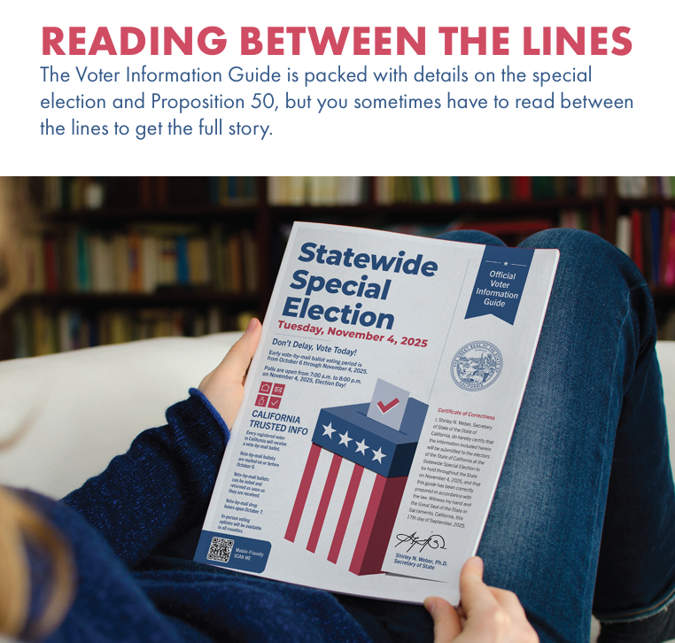
Learn more about the special election at this Sac County Elections Department link.
|
District
|
Current Incumbent (Party)
|
Key Changes Under Prop 50
|
Projected Partisan Shift (Based on 2024 Results)
|
|---|---|---|---|
|
CA-01 (Northeastern CA, including Shasta and rural areas)
|
Doug LaMalfa (R)
|
Shifts south toward Democratic Marin County; northern coastal areas (e.g., Eureka) absorbed into CA-02.
|
From ~55% Republican to ~58% Democratic—easy Democratic pickup.
|
|
CA-03 (Sierra Nevada foothills to Nevada border, including Sacramento suburbs)
|
Kevin Kiley (R)
|
Moves eastward from rural/desert areas toward heavily Democratic Sacramento core.
|
From lean Republican to solid Democratic (57%+).
|
|
CA-22 (Central Valley, including Bakersfield)
|
David Valadao (R)
|
Adds more Democratic voters from Fresno and Kern County urban areas, cracking rural GOP base.
|
From narrow Republican hold to toss-up, leaning Democratic.
|
|
CA-41 (Riverside County, Inland Empire)
|
Ken Calvert (R)
|
Redrawn eastward toward Los Angeles metro, incorporating more diverse, Democratic suburbs.
|
From 47% Democratic to 57% Democratic—easy pickup.
|
|
CA-48 (San Diego/Riverside suburbs, including Temecula)
|
Darrell Issa (R)
|
Expands into Democratic-leaning coastal and urban San Diego areas, despite Issa’s 2024 60% win.
|
From solid Republican to toss-up, with nine Democrats already announcing challenges.
|
![]()
New Report Finds Prop 50 Maps Among Most Extreme Gerrymanders in 50 Years
Proposed Maps Dismantle Communities of Color and Reverse Decades of Redistricting Reform
California’s proposed congressional district maps — privately drawn by party insiders and later approved by the state legislature and signed by Governor Gavin Newsom to create Proposition 50 — represent one of the most extreme partisan gerrymanders of the last half century, according to the Gerrymandering Project at Princeton University. With the help of an experienced redistricting demographer, a report released today analyzes the gerrymandered maps for dividing and weakening the political influence of communities of color.
Part one of the report, detailing Proposition 50’s impact on communities of color, can be found here.
“Proposition 50 would undo the historic gains made under California’s citizen-led redistricting commission, where underrepresented communities have secured fairer representation and a stronger political voice,” said Robert Apodaca, Executive Director of United Latinos Action, a grassroots coalition educating and empowering Latino communities and working families. “By lumping agricultural regions together with distant urban centers, these maps dilute local community priorities, splinter apart communities of interest, and ultimately shield political incumbents from accountability.”
Using block-level demographic analysis, this report shows how Prop 50’s maps divide cohesive Asian American, Black, and Latino neighborhoods into multiple districts, diluting their voting power.
The following examples highlight violations of a core principle of independent redistricting: keeping communities of interest intact.
Northern and Central California
Sacramento
Asian American and Black communities in Lemon Hill, Florin, Fruitridge, and Parkway that have long been connected to a nearby Elk Grove congressional seat, have been carved into a district stretching to the rural Nevada border. Merging urban communities of color into a mountain-based district with vastly different policy priorities.
Stockton
Stockton, with its 15 percent Black population, is currently housed within a single congressional seat to preserve the ability of the city’s Black communities to champion certain issues. The new map splits Stockton’s Black neighborhoods across multiple districts, disregarding scores of public testimony presented to the California Citizens Redistricting Commission and the wishes of the commissioner from Stockton, all whom successfully advocated for Stockton to remain whole. The new map also pulls Stockton’s Latino community into a district extending into Fresno County, weakening their influence on issues central to their city and the surrounding county.
East Bay
The proposed district lines divide the historic corridor of Black and other communities of color from Richmond through Bay Point, Pittsburg, Antioch, and Oakley into three congressional districts — splintering shared schools, churches, and civic institutions.
Southern California
San Fernando Valley
The San Fernando Valley, home to one of the nation’s largest Latino populations, includes working-class, renter communities with shared cultural and socioeconomic ties. The new district lines fracture this population by splitting Lake Balboa and Reseda from nearby Latino neighborhoods and attaching them to distant Palmdale and Lancaster.
Eastern San Gabriel Valley
Walnut, Rowland Heights, Hacienda Heights, Diamond Bar, and Chino Hills form a cohesive Asian American corridor that is currently mostly represented under a single congressional district, with Chino Hills drawn into a neighboring Orange County district. The new proposal fractures this corridor into three separate districts, scattering the population in a way that ensures no single district contains enough Asian American residents to influence representation in Congress.
Eastern Los Angeles
El Monte, Baldwin Park, La Puente, West Covina, and Covina comprise the most concentrated Latino region in eastern Los Angeles County. The proposed map splits this corridor into two districts, pairing parts of the community with predominantly white suburbs like Yorba Linda and Anaheim Hills.
Inland Empire
In the Inland Empire, the proposed map divides Hemet and San Jacinto into separate districts, isolating Black residents in a region where shared representation is essential to securing resources. It also fractures the Latino hub of Pomona, Chino, and Ontario by splitting Pomona and detaching Chino from its traditional partners, weakening Latino political power across the region.
Long Beach
Long Beach has long been a center of Black life in Southern California, connected to neighboring cities like Compton, Carson, and Bellflower through shared cultural and political ties. The proposed map severs those connections and instead links Long Beach to wealthier and majority-white coastal cities.
San Diego
In San Diego, communities like City Heights, Bay Terraces, Lemon Grove, and Spring Valley are home to significant Black, East African, Asian, Latino, and immigrant populations that share common issues, yet the proposed map splits them across districts. Nearby Asian American hubs such as Mira Mesa and Rancho Peñasquitos face the same fate, as the proposal reinforces past divisions that fractured these neighborhoods despite documented community opposition.
###
About Protect Voters FIRST
The Protect Voters First coalition is a broad alliance of good government organizations, social justice advocates, community leaders, and everyday Californians committed to keeping elections fair, transparent, and accountable. We believe voters should choose their representatives — not the other way around. By standing together, we are working to defeat Prop 50 and safeguard the independent, citizen-led redistricting reforms that Californians overwhelmingly approved.
Please do not allow this horrific redistricting event to occur due to Governor Nuisance’s corrupt power grab. The last thing this state needs is more liberals!
We agree Kim! If the litigation does not keep Prop 50 off the ballot, SacCountyGOP will be a part of the statewide effort to inform and turn out voters. We will post opportunities to engage on this page.
Would like a yard sign
Diane – you can come by the SacGOP headquarters Mon-Thurs and Saturday from 10am – 2pm to pick up a No on 50 yard sign. We request a donation to cover our costs of $10 per sign or $20 for three signs. Call if you have questions (916) 822-5618. Thanks!
Can I come down and pick a “no on prop 50”?
Thanks for your question Kenny. SacGOP Headquarters has No on 50 yard signs and we are now collecting ballots from Sacramento County voters. All ballots will be hand-delivered to the County Elections office for processing.
Why are there no bumper stickers for this? I went to the Republican office and they didn’t have any. Bumper stickers are a great way to advertise.
We appreciate your suggestion DJ. All resources are being used for yard signs, texting and walking. We have found that folks are not always comfortable putting bumper stickers on their vehicles, but there will be plenty for the 2026 election when we have more time (and hopefully the resources) to offer a variety of election materials.
No on 50